The History of Newsworthy Flooding Events: Interconnections through Natural Phenomena
Introduction
Flooding stands among humanity’s oldest and most devastating natural hazards, shaping societies, economies, and landscapes throughout history. Floods are not merely random occurrences but are driven by a complex interplay of meteorological, hydrological, and oceanic phenomena. With the accelerating pace of global climate change, understanding these mechanisms and their interactions has gained critical contemporary relevance. The record-breaking flood disasters of recent decades—from Hurricane Katrina in the United States to the 2021 Western Europe floods—highlight the urgent need for a nuanced synthesis of historical flood events, their underlying causes, and the broader environmental patterns that connect them.
This report explores newsworthy flooding events globally, focusing on how storms, heavy rainfall, rivers, and oceanic oscillations such as ENSO, AMO, and PDO interlink to create large-scale disasters. The analysis leverages peer-reviewed literature, official reports, observational data, and up-to-date news sources to examine the causal mechanisms behind significant historical floods, the joint roles of meteorology and hydrology, the emerging influence of atmospheric rivers and climate oscillations, and the trends in flood frequency and severity amid a warming world. A structured table summarizes major events, highlighting their causes, affected regions, and outcomes to ground the detailed narrative that follows.
Overview of Notable Historical Flood Events Globally
Floods have been recorded throughout human history, but certain events stand out due to their scale, impact, and the scientific insights they offer into the dynamics of flood disasters. Below is a table summarizing globally significant flood events, followed by comprehensive analysis and contextualization of these events.
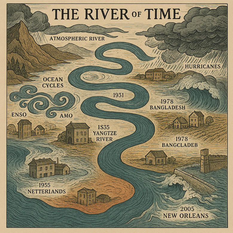
Table 1. Major Flood Events: Causes, Regions, and Outcomes
Year Event Primary Causes Regions Affected Notable Outcomes / Impact 1931 China (Yangtze River) Persistent rainfall, monsoon, cyclones, snowmelt Central & Eastern China Deadliest flood on record; 1.5–4 million deaths, disease, famine, mass displacement 2005 Hurricane Katrina Storm surge, heavy rainfall, levee failures United States (Louisiana, Mississippi) 1,800+ deaths, $125B+ in damages, massive displacement, infrastructure collapse 2010 Pakistan Monsoon Floods Intense monsoon rains, La Niña, river overflow Pakistan (Indus River Basin) 1,985 deaths, $43B damages, 20M affected, epidemics 2011 Thailand Floods Heavy rainfall, La Niña, river overflow, dam issues Thailand, Chao Phraya River Basin ~800–1,026 deaths, $45B+ loss, industrial disruption 2013 Central Europe Floods Prolonged rainfall, saturated soils, river overflow, orographic effects Germany, Austria, Czech Republic 25+ deaths, €12B+ losses, large-scale infrastructure damage 2017 Hurricane Harvey Catastrophic rainfall from stalling hurricane, storm surge Texas, Louisiana (USA) 100+ deaths, $125B+ damages, 60+ inches of rain, mass displacement 2021 Western Europe Floods Extreme rainfall, cut-off low, river overflow Germany, Belgium, Netherlands, others >220 deaths, €46B losses, urban and rural devastation
Each of these events demonstrates how overlapping drivers—sometimes meteorological, sometimes hydrological, and often both—combine to amplify flood risk and impact. The following sections dissect these cases, highlighting the broader environmental and climatic forces that modulate flood behavior.
The 1931 China (Yangtze River) Floods: A Case Study in Compound Disaster
The 1931 floods along China’s Yangtze, Huai, and Yellow Rivers remain the deadliest natural flood disaster on record. This catastrophe resulted from an extraordinary confluence of meteorological extremes and environmental vulnerability:
- Meteorological Precursors: After years of severe drought, the winter preceding the flood left abnormally large snow and ice deposits in China’s mountains. Early 1931 saw a rapid thaw, with snowmelt flowing into already saturated river systems amid heavy and persistent rainfall. The main flooding period featured unprecedented cyclonic activity—nine cyclones in July alone (typical average: two)—and some regions received 1.5 times their annual rain in a single month.
- Hydrological Dynamics: The exceptional rainfall caused river water levels to reach historic peaks. Dike failures, particularly near Gaoyou Lake, led to 18,000 immediate drownings; subsequent disease and famine pushed the death toll as high as 4 million in some estimates.
- Oceanic and Large-Scale Influences: Recent research connects the disaster to a strong El Niño event and resultant weak western Pacific subtropical high, which anchored the monsoon rainband over the Yangtze region. Warm SST anomalies and Eurasian wave activities led to meteorological blocking, preventing the usual northward retreat of the rainband.
- Integrated Impacts: The flood submerged an area the size of England and half of Scotland, causing crop failure, disease (cholera, typhoid, malaria), massive population displacement, and economic trauma. Longstanding social effects included migration, policy reform, and major hydraulic infrastructure investments in the decades that followed (notably, the Three Gorges Dam).
This example vividly illustrates the interplay of meteorological, hydrological, and oceanic systems, amplified by human vulnerability and insufficient flood defenses.
2005 Hurricane Katrina: Coastal, Urban, and Systemic Vulnerability
Hurricane Katrina is emblematic of modern flood disaster, revealing how storms, sea-level changes, and human infrastructure intersect:
- Meteorological Drivers: Katrina formed over the Bahamas and underwent rapid intensification in the Gulf of Mexico due to exceptionally warm waters—a process linked to broader warming trends. At landfall, Katrina drove sustained winds exceeding 125 mph and produced a storm surge measuring over 26 feet along the Mississippi coast.
- Hydrological Catastrophe: Surge and heavy rainfall overwhelmed New Orleans’ levee system, which was inadequately maintained and not designed for such extremes. 80% of the city was inundated, much due to failures of the levees, particularly along the 17th Street, Industrial, and London Avenue canals.
- Oceanic Linkages & Climate Context: Storm strength was further fueled by anomalously high sea surface temperatures in the Gulf of Mexico—partially attributed to the Atlantic Multidecadal Oscillation (AMO) being in a positive (warm) phase, a climate configuration correlated with increased Atlantic hurricane activity.
- Outcomes and Legacy: Katrina led to over 1,800 deaths, $125–170 billion in damage, and long-term depopulation of New Orleans. The disaster exposed flawed emergency management, inadequate infrastructure, and the growing risk urban centers face as sea levels rise and extreme weather intensifies.
Katrina thus stands as both a hydrometeorological and human systems failure, amplifying calls for resilient design in coastal cities and for recognizing the role of oceanic patterns in disaster risk.
2010 Pakistan Monsoon Floods: Climate Variability and Regional Vulnerability
The 2010 floods in Pakistan demonstrate the impact of climate oscillations and persistent rainfall on vulnerable river systems:
- Meteorological Context: Pakistan experienced anomalously high monsoon rainfall, with July and August totals reaching 70–100% above normal. The event was attributed to an active La Niña phase in the El Niño Southern Oscillation (ENSO) cycle, which intensified the Asian monsoon over the region. A "blocking" jet stream configuration further stalled systems, promoting heavy, persistent downpours.
- Hydrological Effects: The Indus River and its tributaries were overwhelmed by rapid runoff. The scale of flooding was exacerbated by deforestation and sedimentation, which reduced floodplain absorption and channeled flows toward populated lowlands. The natural floodplain was also constricted by embankments and irrigation infrastructure, which failed under the volume of water.
- Outcomes: Approximately one-fifth of Pakistan’s land area was submerged, affecting 20 million people and inflicting over $40 billion in damages. Epidemics of waterborne diseases followed, and the destruction of agriculture had long-term economic consequences, particularly for subsistence farmers and rural communities.
The 2010 Pakistan floods illustrate how large-scale climate patterns such as ENSO, when combined with vulnerable river and land management systems, can result in unprecedented humanitarian and economic disasters.
2011 Thailand Floods: Persistent Rainfall, La Niña, and Infrastructure Exposure
Thailand's 2011 floods were characterized by several interrelated phenomena:
- Precipitation and Storms: Thailand experienced record rainfall—the highest in over 60 years—attributed to the cumulative effects of multiple tropical storms and the ongoing La Niña phase, which enhances monsoon strength in Southeast Asia.
- Hydrological Dynamics: The Chao Phraya River basin could not accommodate excess precipitation, and dam reservoirs, already full after a prior active monsoon, contributed to downstream flooding as controlled releases became necessary. This scenario was exacerbated by land subsidence in urban areas, reduced retention capacity due to land-use change, and aging flood-control infrastructure.
- Integrated Outcomes: Over 800 deaths occurred, and economic losses exceeded $45 billion. Major supply chains were disrupted, as Thailand’s role as a global manufacturing hub for electronics and automobiles meant that industrial parks flooding impacted production worldwide.
Here, meteorological anomalies combining with river dynamics and human systems (dams, industrial developments, urbanization) created a high-impact disaster, emphasizing the importance of integrated water resource management.
2013 Central Europe Floods: Atmospheric Circulation and River Confluence
The 2013 floods throughout Central Europe exemplify the consequences of persistent atmospheric and hydrological anomalies:
- Meteorological Setting: Central Europe in spring 2013 was characterized by saturated soils from previous rainfall and an unusual stationary low-pressure system, leading to several consecutive days of extreme rainfall. This was reinforced by orographic effects (lifting of moist air over mountains) and “planetary wave resonance” patterns, which can “lock” weather systems in place for extended periods.
- Hydrological Mechanisms: Major rivers such as the Danube and Elbe were driven to record flow levels as their tributaries peaked simultaneously. Flood synchronization exacerbated the scale of inundation, and in places like Passau, the river crested at levels not seen since the Middle Ages.
- Impacts: Across Germany, Austria, and Czechia, these floods resulted in 25 deaths, €12 billion in damage, and widespread infrastructure disruption, including the closure of railways and loss of industrial productivity for weeks.
In this event, the interaction of meteorological locking, saturated landscapes, and the structural dynamics of major river systems led to one of the most extensive recent European disasters.
2017 Hurricane Harvey: The Role of a Stalling Hurricane and Urban Susceptibility
Hurricane Harvey’s legacy is defined by extreme rainfall and urban vulnerability:
- Meteorological Features: Harvey rapidly intensified in the Gulf of Mexico and stalled over Southeast Texas due to weak steering currents between high-pressure systems, maintaining its access to moist Gulf air and continuously producing torrential rain.
- Rainfall and River Response: Record-breaking rainfall totals exceeded 60 inches in some parts of Houston and southeast Texas. The combination of a slow-moving system and deeply saturated soils led to new records on virtually every river in the region. Major infrastructure failures resulted as water volumes overwhelmed stormwater networks and led to prolonged high water stages.
- Outcomes: Over 100 people died, damages topped $125 billion, and over 100,000 homes sustained significant flooding. Mass evacuations were required, and pollution from inundated refineries and hazardous waste sites introduced severe public health issues.
Harvey is often cited as the costliest flood disaster in U.S. history, revealing both the vulnerability of urbanized regions to persistent storms and the influence of oceanic warmth and atmospheric stalling patterns on flood risk.
2021 Western Europe Floods: Flash Floods in a Changing Climate
The 2021 Western Europe floods exemplify the new era of climate-amplified disasters:
- Meteorological Triggers: A cut-off low-pressure system stalled over Western Europe, drawing moist air from the unusually warm Baltic Sea. The region received record-shattering amounts of rain over two days, with over 200mm recorded in places—an amount not seen in over a century, perhaps longer.
- Hydrological Amplification: River catchments in the Eifel-Ardennes region (Germany, Belgium, Netherlands) were already wetted by prior precipitation. Rapid runoff from steep terrain led to flash floods on rivers such as the Ahr and Erft, overwhelming flood defenses that were designed for much smaller events and prompting catastrophic infrastructural collapse.
- Climate and Oceanic Influences: While no explicit link to ENSO or AMO was established for this specific event, the role of slow-moving atmospheric circulation—a symptom expected to increase with Arctic warming—alongside increased atmospheric moisture due to global temperature rise, was highlighted as a significant factor. Climate models suggest such events will become more frequent as the footprint of human-driven warming grows.
- Outcomes: Over 220 deaths occurred, countless homes and bridges were destroyed, and the economic losses exceeded €46 billion. Exacerbating the situation was the remobilization of industrial and mining pollutants, highlighting the interplay between environmental, climatic, and human factors.
This disaster powerfully illustrates the “new normal” of compounded weather hazards in a warming Europe.
Meteorological Drivers: Heavy Rainfall and Storm Systems
Flood events often begin with meteorological phenomena:
- Extreme Rainfall: Most major floods are triggered by extraordinary precipitation events—sustained or intense rains, often delivered by storms, monsoon systems, hurricanes, or atmospheric instability.
- Storm Systems:
- Monsoon Systems: In South and Southeast Asia, such as the 2010 Pakistan and 2011 Thailand floods, the seasonal monsoon system governs large-scale precipitation. ENSO phases can shift monsoon strength and distribution.
- Tropical Cyclones and Hurricanes: Hurricanes Katrina and Harvey in the US, and Typhoon Nina (1975) in China, show the disastrous flood potential of tropical storms, which combine heavy rain and storm surge.
- Atmospheric Blocking: Stationary weather patterns, such as blocking highs or stalled cut-off lows, can anchor wet conditions over a region for days, as seen in the 2013 Central Europe and 2021 Western Europe floods.
The interplay between atmospheric rivers (long, narrow moisture plumes) and orography (mountains) further intensifies rainfall totals. In recent years, atmospheric rivers have been linked to catastrophic U.S. West Coast and European flooding.
Hydrological Drivers: River Overflow Dynamics
Hydrological conditions dramatically modulate flood behavior:
- River Channel Capacity and Soil Saturation: Rivers have limited capacity, defined by cross-sectional area, depth, and gradient. When rainfall exceeds absorption and river capacity, flooding occurs. Preceding soil moisture, snowpack, and the presence of dams or levees can influence how much water runs off versus infiltrates.
- Compounding Factors: Floods often result from interactions between rainfall and antecedent conditions. For instance:
- 2013 Central Europe: Heavy rainfall fell onto already saturated soils, leading to rapid runoff and river cresting.
- 2011 Thailand: Prolonged rainfall on top of full dam reservoirs required controlled releases, worsening downstream flooding.
- Compound Flooding: Urban settings introduce additional complexities, with impervious surfaces accelerating runoff and creating flash floods, as notably demonstrated in Hurricane Harvey’s impact on Houston.
- Return Periods: Statistical metrics, such as the 100-year or 1-in-1000-year events, are used to represent the rarity of given flood magnitudes. However, observed frequencies for “rare” events have been rising in many regions.
Oceanic Influences: El Niño–Southern Oscillation, AMO, and PDO
Large-scale ocean patterns exert significant, and sometimes predictable, influences on flood risk around the world:
El Niño–Southern Oscillation (ENSO)
- Periodic Climate Pattern: ENSO shifts every 2–7 years between El Niño (warming of eastern Pacific) and La Niña (cooling of the same region). These phases modulate precipitation across the globe: e.g., El Niño tends to make parts of South America and southeast China wetter, while La Niña enhances rainfall in South and Southeast Asia and eastern Australia.
- Flood Risk: Studies show that during El Niño and La Niña years, statistically significant flood anomalies occur over 34–38% of the global land area, with impacts varying regionally. ENSO is a dominant climate driver for flood hazard in ~44% of Earth’s land surface and can be used to anticipate seasonal flood risks.
- Case Examples: The 2010 Pakistan flood (La Niña), 1931 Yangtze Flood (El Niño), and many Australian flood years all show strong ENSO links.
Atlantic Multidecadal Oscillation (AMO)
- Multi-Decadal Patterns: The AMO reflects swings in Atlantic sea surface temperatures with warm and cool phases over decades. The warm phase strengthens hurricane activity in the Atlantic and can increase flood risk in the US and Europe. Droughts in the Sahel and U.S. Midwest, and floods in the UK, are also associated with AMO phase changes.
- Interaction with Hurricanes and Rainfall: The positive AMO phase in the late 1990s–2010s paralleled increased Atlantic hurricane activity, helping set the stage for Katrina (2005) and Harvey (2017).
Pacific Decadal Oscillation (PDO)
- Decadal Variability: The PDO influences ENSO’s effects, especially in North America and the western Pacific. During PDO positive phases, ENSO’s impacts can be amplified, altering precipitation and flood frequency in North America and Asia.
- Research Insights: Evidence suggests that the number of major floods in Europe and North America over the last 80 years varies in line with AMO and PDO patterns, rather than showing a simple linear increase—emphasizing the importance of natural climate variability in shaping flood probability.
Atmospheric Rivers and Extreme Precipitation
- Atmospheric Rivers (ARs): These are long, narrow bands of moisture, often hundreds of kilometers wide and thousands long, transporting large water volumes from the tropics to midlatitudes. When ARs make landfall—especially on mountainous coasts—they release torrential rains, as seen in California, the Pacific Northwest, and Western Europe. ARs have become more frequent and intense in many regions, likely linked to warming oceans and increased global moisture content.
- Recent Disasters: Atmospheric rivers were central to the 2017 California winter floods and are increasingly recognized as key contributors to European flood disasters of the 21st century.
Climate Change Trends in Flood Frequency and Magnitude
- Growing Frequency and Intensity: Multiple studies indicate that both heavy precipitation events and associated flood damages have increased in recent decades, a trend consistent with climate change theory—the warmer the atmosphere, the more moisture it can hold, leading to heavier rainfall.
- Economic Impact: In the U.S., for example, the annual total costs of flood damages have rapidly risen—over a third of these costs since 1988 are attributed to changes in precipitation extremes, with the effects projected to intensify without robust mitigation measures.
- Projections: By 2100, global flooding may increase by 9–49%, depending on emissions scenarios. Coastal flooding, in particular, is expected to double or more even in optimistic warming scenarios, especially where sea-level rise compounds extreme rainfall effects.
- Hotspots: Increases are most certain in tropical Asia, Africa, and along global coastlines, though regional variability and uncertainty remain high.
Integrated Mechanisms: Interactions of Storms, Rivers, and Ocean Patterns
- Compound and Cascading Events: Many historical and recent floods arise from the combined action of meteorological extremes (storms, cyclones, atmospheric rivers), hydrological preconditioning (saturated soils, full rivers, snowmelt), and occasionally, sea-level effects (storm surge, high tides).
- Flood Complexity: Recent machine learning studies show that as flood magnitude increases, the likelihood of multiple drivers (rainfall, soil moisture, temperature, snowmelt) acting in tandem rises significantly. Over 50% of floods globally result from at least two interacting factors, and for rare/extreme floods, three or more drivers are often implicated.
- Example: Germany’s 2021 flash floods resulted from unprecedented rain onto saturated soils in steep catchments with vulnerable human settlements and infrastructure.
- Temporal Changes: Empirical and model-based studies document that flood drivers and their relative importance can shift over time within individual watersheds, often due to climatic regime changes, land use alteration, or engineered hydrology.
Synthesis and Conclusion
From the ancient Yangtze basin to modern metropolises, the story of global flooding is one of intersection—between meteorology, hydrology, oceanic variability, and human forces. Historical examples underscore several recurring themes:
- Floods are rarely due to a single cause. The deadliest and most disruptive events almost always result from the convergence of extreme rainfall/storms, landscape/river vulnerabilities, and, increasingly, the influences of climate oscillations and a warming, more humid planet.
- Oceanic patterns such as ENSO, AMO, and PDO exert profound but regionally variable control on flood risk. As evidenced by the links between La Niña phases and South Asian floods, or AMO’s correlation with hurricane activity, these slow-moving cycles create windows of elevated (or reduced) vulnerability spanning continents.
- Hydrological and flood risk is shaped not only by input (precipitation) but by the readiness of the landscape and infrastructure to absorb or route water. This makes antecedent soil moisture, snowpack, land use, river management, and urbanization central to understanding modern disasters.
- Climate change acts as a force multiplier, intensifying many of the underlying mechanisms—heavier storms, higher sea levels, altered snowmelt patterns, and more frequent atmospheric river landfalls. Observational and model evidence converge in projecting a world where “historic” floods become increasingly normal unless significant adaptation and mitigation occur.
The future of flood risk management will depend on synthesizing real-time observational data (especially from remote sensing and river gauges), high-resolution climate model projections, and adaptive infrastructure planning grounded in an integrated perspective on risk. Explicitly accounting for the shifting tapestry of meteorological, hydrological, and oceanic interactions—as well as how warming climate alters their probabilities—will be critical for designing resilient societies in the flood-prone centuries ahead.
Key Takeaways:
- Flood disasters are shaped by a confluence of storms, rainfall, rivers, and oceanic climate patterns.
- Major historic floods often occur when meteorological and hydrological extremes coincide, frequently under the influence of ENSO, AMO, or PDO.
- Recent trends indicate that extreme floods are becoming more frequent and severe, with climate change playing an ever-more prominent role.
- Flood management requires integrated approaches—linking climate forecasts, land-use planning, river engineering, and community adaptation—to reduce future risk and damage.
Great idea—I'll dive into the history of major flooding events and explore how storms, rainfall, rivers, and oceanic forces all contribute to these disasters. This will take me several minutes, so feel free to step away if needed. I’ll keep working in the background and save the report right here in our conversation so you can check back anytime.